
Thank you for supporting this site ❤️
Make a donation
Make a donation
Palaichori Morfou topographic map
Click on the map to display elevation.
Thank you for supporting this site ❤️
Make a donation
Make a donation
Palaichori Morfou
Palaichori Morphou (Greek: Παλαιχώρι Μόρφου) is a village located in the Nicosia District of Cyprus on the E 903 road. The village stands at an altitude of 930 m. Palaichori Morphou is separated from Palaichori Oreinis by the Serrache River.
Thank you for supporting this site ❤️
Make a donation
Make a donation
About this map
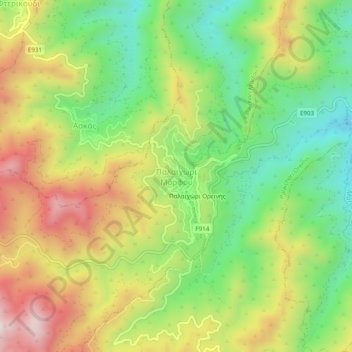
Name: Palaichori Morfou topographic map, elevation, terrain.
Location: Palaichori Morfou, Nicosia District, Cyprus (34.90379 33.07100 34.94379 33.11100)
Average elevation: 964 m
Minimum elevation: 689 m
Maximum elevation: 1,312 m
Thank you for supporting this site ❤️
Make a donation
Make a donation