
Thank you for supporting this site ❤️
Make a donation
Make a donation
Ryssby topographic map
Click on the map to display elevation.
Thank you for supporting this site ❤️
Make a donation
Make a donation
About this map
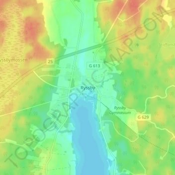
Name: Ryssby topographic map, elevation, terrain.
Location: Ryssby, Ljungby kommun, Kronobergs län, 341 76, Zweden (56.84449 14.14791 56.88449 14.18791)
Average elevation: 152 m
Minimum elevation: 133 m
Maximum elevation: 174 m
Thank you for supporting this site ❤️
Make a donation
Make a donation
Other topographic maps
Click on a map to view its topography, its elevation and its terrain.