
Kampung Parit Sonto topographic map
Interactive map
Click on the map to display elevation.
About this map
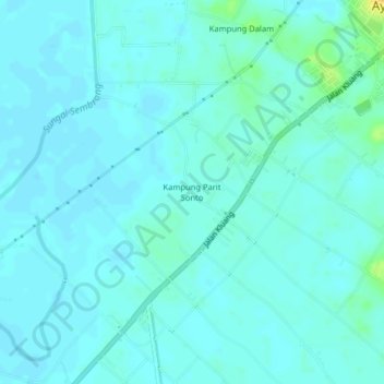
Name: Kampung Parit Sonto topographic map, elevation, terrain.
Location: Kampung Parit Sonto, Ayer Hitam, Batu Pahat, Johor, Malaysia (1.87869 103.13736 1.91869 103.17736)
Average elevation: 6 m
Minimum elevation: 1 m
Maximum elevation: 29 m
Other topographic maps
Click on a map to view its topography, its elevation and its terrain.
Kampung Dalam
Malaysia > Johor > Ayer Hitam
Kampung Dalam, Ayer Hitam, Batu Pahat, Johor, Malaysia
Average elevation: 7 m