
Thank you for supporting this site ❤️
Make a donation
Make a donation
Castelo Mendo topographic map
Click on the map to display elevation.
Thank you for supporting this site ❤️
Make a donation
Make a donation
About this map
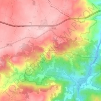
Name: Castelo Mendo topographic map, elevation, terrain.
Location: Castelo Mendo, Almeida, Guarda, Portugal (40.57451 -6.96859 40.61451 -6.92859)
Average elevation: 722 m
Minimum elevation: 585 m
Maximum elevation: 811 m
Thank you for supporting this site ❤️
Make a donation
Make a donation
Other topographic maps
Click on a map to view its topography, its elevation and its terrain.