
Thank you for supporting this site ❤️
Make a donation
Make a donation
Kigangazi topographic map
Click on the map to display elevation.
Thank you for supporting this site ❤️
Make a donation
Make a donation
About this map
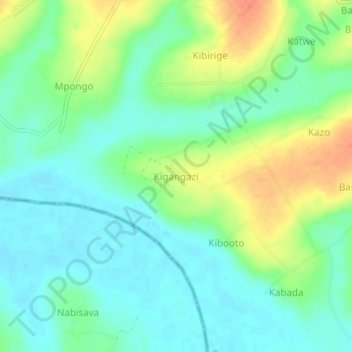
Name: Kigangazi topographic map, elevation, terrain.
Location: Kigangazi, Kyankwanzi, Central Region, Uganda (1.14792 31.39872 1.18792 31.43872)
Average elevation: 1,090 m
Minimum elevation: 1,073 m
Maximum elevation: 1,119 m
Thank you for supporting this site ❤️
Make a donation
Make a donation