
Thank you for supporting this site ❤️
Make a donation
Make a donation
Rotnes topographic map
Click on the map to display elevation.
Thank you for supporting this site ❤️
Make a donation
Make a donation
About this map
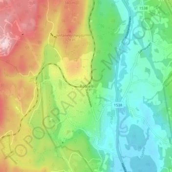
Name: Rotnes topographic map, elevation, terrain.
Location: Rotnes, Nittedal, Akershus, 1482, Norge (60.03832 10.84756 60.07832 10.88756)
Average elevation: 209 m
Minimum elevation: 105 m
Maximum elevation: 389 m
Thank you for supporting this site ❤️
Make a donation
Make a donation
Other topographic maps
Click on a map to view its topography, its elevation and its terrain.
Thank you for supporting this site ❤️
Make a donation
Make a donation
Thank you for supporting this site ❤️
Make a donation
Make a donation