
Thank you for supporting this site ❤️
Make a donation
Make a donation
Tiaro topographic map
Click on the map to display elevation.
Thank you for supporting this site ❤️
Make a donation
Make a donation
About this map
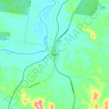
Name: Tiaro topographic map, elevation, terrain.
Location: Tiaro, Fraser Coast Regional, Queensland, Australia (-25.76732 152.54284 -25.68732 152.62284)
Average elevation: 40 m
Minimum elevation: 3 m
Maximum elevation: 182 m
Thank you for supporting this site ❤️
Make a donation
Make a donation