
Thank you for supporting this site ❤️
Make a donation
Make a donation
Katabi Busambaga topographic map
Click on the map to display elevation.
Thank you for supporting this site ❤️
Make a donation
Make a donation
About this map
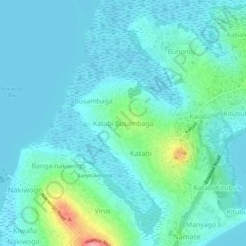
Name: Katabi Busambaga topographic map, elevation, terrain.
Location: Katabi Busambaga, Entebbe City, Central Region, Uganda (0.06927 32.44758 0.10927 32.48758)
Average elevation: 1,147 m
Minimum elevation: 1,131 m
Maximum elevation: 1,227 m
Thank you for supporting this site ❤️
Make a donation
Make a donation