
Thank you for supporting this site ❤️
Make a donation
Make a donation
Maiden Newton topographic map
Click on the map to display elevation.
Thank you for supporting this site ❤️
Make a donation
Make a donation
About this map
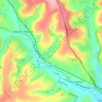
Name: Maiden Newton topographic map, elevation, terrain.
Location: Maiden Newton, Dorset, England, United Kingdom (50.74509 -2.58438 50.79251 -2.53243)
Average elevation: 138 m
Minimum elevation: 70 m
Maximum elevation: 233 m
Thank you for supporting this site ❤️
Make a donation
Make a donation
Other topographic maps
Click on a map to view its topography, its elevation and its terrain.
Thank you for supporting this site ❤️
Make a donation
Make a donation
Thank you for supporting this site ❤️
Make a donation
Make a donation