
Lelep topographic map
Interactive map
Click on the map to display elevation.
About this map
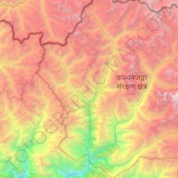
Name: Lelep topographic map, elevation, terrain.
Location: Lelep, Taplejung, Mechi, Eastern Development Region, Nepal (27.49164 87.71169 27.90609 88.20153)
Average elevation: 4,382 m
Minimum elevation: 1,299 m
Maximum elevation: 7,466 m