
桑多镇 topographic map
Interactive map
Click on the map to display elevation.
About this map
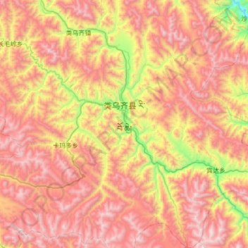
Name: 桑多镇 topographic map, elevation, terrain.
Location: 桑多镇, Riwoqê, Chamdo, Tibet, Chine (30.96962 96.48800 31.42951 96.80734)
Average elevation: 4,483 m
Minimum elevation: 3,405 m
Maximum elevation: 5,432 m