
Zimmet topographic map
Interactive map
Click on the map to display elevation.
About this map
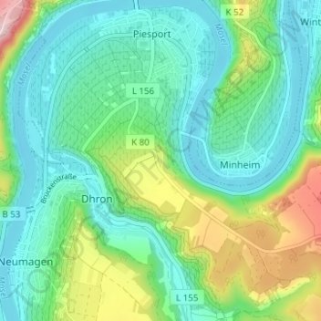
Name: Zimmet topographic map, elevation, terrain.
Average elevation: 185 m
Minimum elevation: 107 m
Maximum elevation: 403 m
Other topographic maps
Click on a map to view its topography, its elevation and its terrain.
Moselloreley
Duitsland > Rijnland-Palts > Landkreis Bernkastel-Wittlich > Piesport
Moselloreley, Römerfeld, Müstert, Piesport, Bernkastel-Kues, Landkreis Bernkastel-Wittlich, Rijnland-Palts, 54498, Duitsland
Average elevation: 165 m
Pestkapelle
Duitsland > Rijnland-Palts > Landkreis Bernkastel-Wittlich > Piesport
Pestkapelle, Moselstraße, Niederemmel, Piesport, Bernkastel-Kues, Landkreis Bernkastel-Wittlich, Rijnland-Palts, 54498, Duitsland
Average elevation: 167 m