
Thank you for supporting this site ❤️
Make a donation
Make a donation
Rockland topographic map
Click on the map to display elevation.
Thank you for supporting this site ❤️
Make a donation
Make a donation
About this map
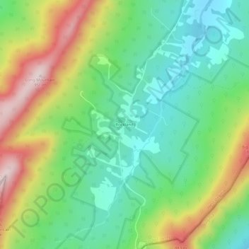
Name: Rockland topographic map, elevation, terrain.
Location: Rockland, Hardy County, West Virginia, United States (38.92428 -78.71252 38.96428 -78.67252)
Average elevation: 675 m
Minimum elevation: 517 m
Maximum elevation: 948 m
Thank you for supporting this site ❤️
Make a donation
Make a donation
Other topographic maps
Click on a map to view its topography, its elevation and its terrain.