
Albrechts topographic map
Interactive map
Click on the map to display elevation.
About this map
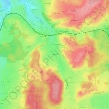
Name: Albrechts topographic map, elevation, terrain.
Average elevation: 831 m
Minimum elevation: 753 m
Maximum elevation: 899 m
Other topographic maps
Click on a map to view its topography, its elevation and its terrain.
Lechbruck am See
Deutschland > Bayern > Landkreis Ostallgäu > Lechbruck a.See
Lechbruck am See, Lechbruck a.See, Landkreis Ostallgäu, Bayern, 86983, Deutschland
Average elevation: 755 m
Hirschwang
Deutschland > Bayern > Landkreis Ostallgäu > Halblech
Hirschwang, Halblech, Landkreis Ostallgäu, Bayern, Deutschland
Average elevation: 1,481 m
Füssen
Deutschland > Bayern > Landkreis Ostallgäu
Füssen, Landkreis Ostallgäu, Bayern, 87629, Deutschland
Average elevation: 852 m