
Municipality of Galatsi topographic map
Interactive map
Click on the map to display elevation.
About this map
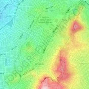
Name: Municipality of Galatsi topographic map, elevation, terrain.
Average elevation: 176 m
Minimum elevation: 87 m
Maximum elevation: 317 m
Other topographic maps
Click on a map to view its topography, its elevation and its terrain.
Athens
Greece > Attica > Regional Unit of Central Athens
Athens, Municipality of Athens, Regional Unit of Central Athens, Attica, 105 57, Greece
Average elevation: 168 m
Municipality of Zografos
Greece > Attica > Regional Unit of Central Athens
Municipality of Zografos, Regional Unit of Central Athens, Attica, Greece
Average elevation: 333 m
Municipality of Dafni - Ymittos
Greece > Attica > Regional Unit of Central Athens
Municipality of Dafni - Ymittos, Regional Unit of Central Athens, Attica, Greece
Average elevation: 128 m
Areopagus
Greece > Attica > Regional Unit of Central Athens > Athens
Areopagus, Athens, Municipality of Athens, Regional Unit of Central Athens, Attica, 105 55, Greece
Average elevation: 75 m