
Thank you for supporting this site ❤️
Make a donation
Make a donation
Xining City topographic map
Click on the map to display elevation.
Thank you for supporting this site ❤️
Make a donation
Make a donation
About this map
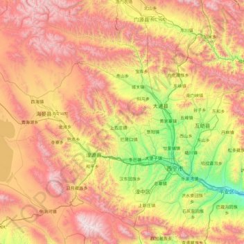
Name: Xining City topographic map, elevation, terrain.
Location: Xining City, Qinghai, China (36.22969 100.87031 37.46987 101.91223)
Average elevation: 3,215 m
Minimum elevation: 2,072 m
Maximum elevation: 4,799 m
Thank you for supporting this site ❤️
Make a donation
Make a donation