
Make a donation
Bob topographic map
Click on the map to display elevation.
Make a donation
About this map
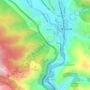
Name: Bob topographic map, elevation, terrain.
Location: Bob, Municipality of Kaçanik, 71000, Kosovo (42.21196 21.21800 42.23353 21.25748)
Average elevation: 610 m
Minimum elevation: 460 m
Maximum elevation: 832 m
Make a donation
Other topographic maps
Click on a map to view its topography, its elevation and its terrain.
Goljak
Kosovo > Jablanica Administrative District > Medvedja Municipality
Gollak (Albanian definite form: Gollaku; Serbian: Гољак, romanized: Goljak) or Gallap (Albanian definite form: Gallapi) is a mountainous and ethnographic region in the eastern part of Kosovo and partially in Serbia, bordering the Llap region to the North, the Kosovo field to the west, the Anamorava valley…
Average elevation: 983 m
Make a donation
Make a donation
Malet e Sharrit / Шар Планина
The Šar Mountains are located in the south and south-east of Kosovo, where 43.12% of the range is located. Many alpine and glacial mountain lakes are found on the Kosovar part of the Šar Mountains, especially south of the town of Dragash, the area of Shutman and the region north of Vraca. The Brezovica ski…
Average elevation: 818 m
Make a donation
Make a donation
Make a donation
Make a donation
Make a donation
Make a donation
Make a donation
Make a donation
Make a donation
Make a donation
Make a donation
Gjeravica
Gjeravica (Albanian indefinite form: Gjeravicë; Serbian: Ђеравица / Đeravica) is a mountain peak in Kosovo. It also is the second-highest mountain peak in the Accursed Mountains range and the Dinaric Alps range, after Jezercë. It has an elevation of 2,656 m (8,714 ft) above sea level. Gjeravica is…
Average elevation: 2,214 m
Fushë Kosovë
Kosovo Polje is a municipality that lies in the center of the Kosovo Plain, with an area of 84 km2 (32 sq mi) and an altitude of 540 m (1,772 ft) above sea level. The city is situated between Pristina in the east, Obiliq in the north, Gračanica in the south and Drenas in the west. It consists of 16…
Average elevation: 558 m
Make a donation
Make a donation
Make a donation
Make a donation
Make a donation
Make a donation
Bogë
Bogë is a small mountainous village and also a holiday resort village in western Kosovo. Bogë is located in the Accursed Mountains (also known as Albanian Alps) mountain range on an altitude of about 1,300–1,400 metres (4,300–4,600 ft). Nearby the village is located the peak of Hajla at 2,403 metres…
Average elevation: 1,538 m
Make a donation
Make a donation
Make a donation
Make a donation
Make a donation
Make a donation