
Kayna topographic map
Interactive map
Click on the map to display elevation.
About this map
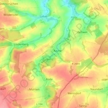
Name: Kayna topographic map, elevation, terrain.
Location: Kayna, Zeitz, Burgenlandkreis, Sachsen-Anhalt, Deutschland (50.97121 12.20247 51.01307 12.27785)
Average elevation: 245 m
Minimum elevation: 197 m
Maximum elevation: 283 m