
Make a donation
Qaladiza topographic map
Click on the map to display elevation.
Make a donation
About this map
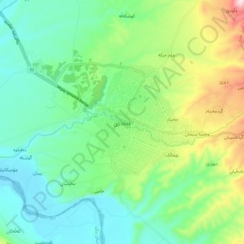
Name: Qaladiza topographic map, elevation, terrain.
Average elevation: 617 m
Minimum elevation: 506 m
Maximum elevation: 890 m
Make a donation
Other topographic maps
Click on a map to view its topography, its elevation and its terrain.
Make a donation
Make a donation
Make a donation
Make a donation
Make a donation
Make a donation
Make a donation
Make a donation
Make a donation
Make a donation
Halabja Governorate
Halabja is located in the Shahrizor plain, a fertile valley nestled in the foothills of the Zagros Mountains in the Kurdistan Region of Iraq. The city's elevation is around 700 meters above sea level. The surrounding area is characterized by mountainous terrain, with the Hawraman Mountain range to the east,…
Average elevation: 1,055 m
Make a donation
Make a donation
Make a donation
Make a donation
Darbandikhan Dam
The dam is located within a gorge on a foundation of sedimentary rocks. It is a rock-fill embankment type with a central clay core. The dam is 128 m (420 ft) tall and 445 m (1,460 ft) long (535 m (1,755 ft) if the spillway section is included). Its crest is 17 m (56 ft) wide and at an elevation of 495 m (1,624…
Average elevation: 571 m
Make a donation
Make a donation
Make a donation
Make a donation
Make a donation
Make a donation
Make a donation
Make a donation
Make a donation
Al-Anbar Governorate
Anbar is one of the driest governorates in Iraq's western desert climate. Some of Al Anbar is part of the Syrian Desert, characterized by steppe and desert terrain. Most of Al Anbar is considered as a topographical continuation of the Arabian Peninsula plateau region. It has some small hills and a number of…
Average elevation: 399 m
Make a donation
Make a donation