
Thank you for supporting this site ❤️
Make a donation
Make a donation
Jipang topographic map
Click on the map to display elevation.
Thank you for supporting this site ❤️
Make a donation
Make a donation
About this map
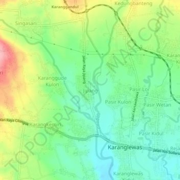
Name: Jipang topographic map, elevation, terrain.
Location: Jipang, Banyumas, Central Java, Java, 53161, Indonesia (-7.42812 109.17156 -7.38812 109.21156)
Average elevation: 106 m
Minimum elevation: 58 m
Maximum elevation: 187 m
Thank you for supporting this site ❤️
Make a donation
Make a donation
Other topographic maps
Click on a map to view its topography, its elevation and its terrain.