
Slufter topographic map
Interactive map
Click on the map to display elevation.
About this map
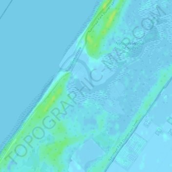
Name: Slufter topographic map, elevation, terrain.
Average elevation: 1 m
Minimum elevation: -5 m
Maximum elevation: 13 m
Other topographic maps
Click on a map to view its topography, its elevation and its terrain.
Zuid-Eierland
Niederlande > Nordholland > De Cocksdorp
Zuid-Eierland, De Cocksdorp, Texel, Nordholland, Niederlande, 1795 JK, Niederlande
Average elevation: 0 m