
Thank you for supporting this site ❤️
Make a donation
Make a donation
Redipuertas topographic map
Click on the map to display elevation.
Thank you for supporting this site ❤️
Make a donation
Make a donation
About this map
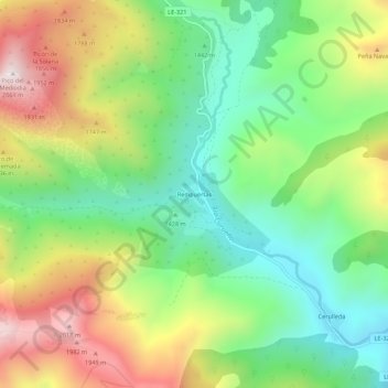
Name: Redipuertas topographic map, elevation, terrain.
Location: Redipuertas, Valdelugueros, León, Castilla y León, España (42.99336 -5.46505 43.03336 -5.42505)
Average elevation: 1,559 m
Minimum elevation: 1,230 m
Maximum elevation: 2,054 m
Thank you for supporting this site ❤️
Make a donation
Make a donation