
Thank you for supporting this site ❤️
Make a donation
Make a donation
Papaya topographic map
Click on the map to display elevation.
Thank you for supporting this site ❤️
Make a donation
Make a donation
About this map
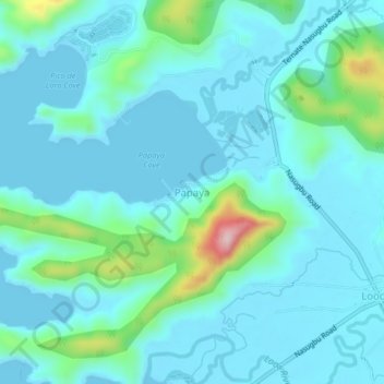
Name: Papaya topographic map, elevation, terrain.
Location: Papaya, Nasugbu, Batangas, Calabarzon, 4231, Philippines (14.15478 120.58811 14.19478 120.62811)
Average elevation: 39 m
Minimum elevation: -2 m
Maximum elevation: 266 m
Thank you for supporting this site ❤️
Make a donation
Make a donation
Other topographic maps
Click on a map to view its topography, its elevation and its terrain.