
Loreto topographic map
Interactive map
Click on the map to display elevation.
About this map
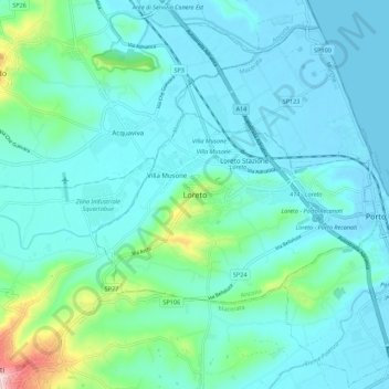
Name: Loreto topographic map, elevation, terrain.
Location: Loreto, Ancona, Marche, 60025, Italia (43.39950 13.56702 43.47950 13.64702)
Average elevation: 45 m
Minimum elevation: -3 m
Maximum elevation: 298 m