
Thank you for supporting this site ❤️
Make a donation
Make a donation
Isreal-matovu topographic map
Click on the map to display elevation.
Thank you for supporting this site ❤️
Make a donation
Make a donation
About this map
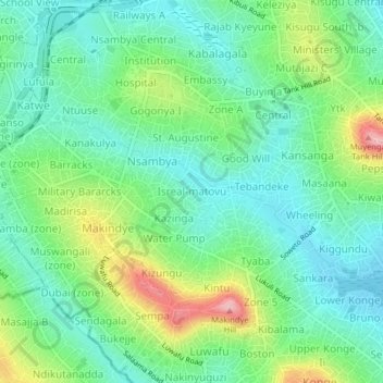
Name: Isreal-matovu topographic map, elevation, terrain.
Location: Isreal-matovu, Kampala, Uganda (0.26820 32.57247 0.30820 32.61247)
Average elevation: 1,187 m
Minimum elevation: 1,138 m
Maximum elevation: 1,299 m
Thank you for supporting this site ❤️
Make a donation
Make a donation
Other topographic maps
Click on a map to view its topography, its elevation and its terrain.