
El Golfete topographic map
Interactive map
Click on the map to display elevation.
About this map
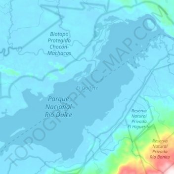
Name: El Golfete topographic map, elevation, terrain.
Location: El Golfete, Livingston, Izabal, Guatemala (15.68347 -88.95203 15.79215 -88.81802)
Average elevation: 50 m
Minimum elevation: -5 m
Maximum elevation: 948 m
Other topographic maps
Click on a map to view its topography, its elevation and its terrain.