
Thank you for supporting this site ❤️
Make a donation
Make a donation
La Soie topographic map
Click on the map to display elevation.
Thank you for supporting this site ❤️
Make a donation
Make a donation
About this map
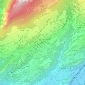
Name: La Soie topographic map, elevation, terrain.
Location: La Soie, Saint-Germain, Savièse, Sion, Valais, 1965, Suisse (46.23423 7.33173 46.27423 7.37173)
Average elevation: 913 m
Minimum elevation: 488 m
Maximum elevation: 1,744 m
Thank you for supporting this site ❤️
Make a donation
Make a donation