
Senden topographic map
Interactive map
Click on the map to display elevation.
About this map
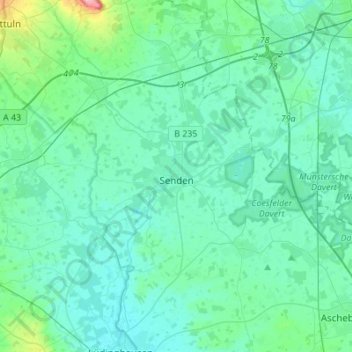
Name: Senden topographic map, elevation, terrain.
Average elevation: 65 m
Minimum elevation: 50 m
Maximum elevation: 166 m
Other topographic maps
Click on a map to view its topography, its elevation and its terrain.
Ascheberg
Allemagne > Rhénanie-du-Nord-Westphalie > Kreis Coesfeld > Ascheberg
Ascheberg, Kreis Coesfeld, Rhénanie-du-Nord-Westphalie, 59387, Allemagne
Average elevation: 71 m