
Thank you for supporting this site ❤️
Make a donation
Make a donation
Möser topographic map
Click on the map to display elevation.
Thank you for supporting this site ❤️
Make a donation
Make a donation
About this map
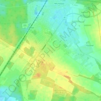
Name: Möser topographic map, elevation, terrain.
Location: Möser, Jerichower Land, Sachsen-Anhalt, Deutschland (52.19542 11.77594 52.22627 11.82736)
Average elevation: 71 m
Minimum elevation: 57 m
Maximum elevation: 84 m
Thank you for supporting this site ❤️
Make a donation
Make a donation