
Thank you for supporting this site ❤️
Make a donation
Make a donation
Moribabougou topographic map
Click on the map to display elevation.
Thank you for supporting this site ❤️
Make a donation
Make a donation
About this map
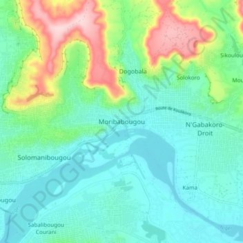
Name: Moribabougou topographic map, elevation, terrain.
Location: Moribabougou, Kati Cercle, Koulikoro, Mali (12.64908 -7.90667 12.72908 -7.82667)
Average elevation: 362 m
Minimum elevation: 302 m
Maximum elevation: 531 m
Thank you for supporting this site ❤️
Make a donation
Make a donation