
Thank you for supporting this site ❤️
Make a donation
Make a donation
Kakuma topographic map
Click on the map to display elevation.
Thank you for supporting this site ❤️
Make a donation
Make a donation
About this map
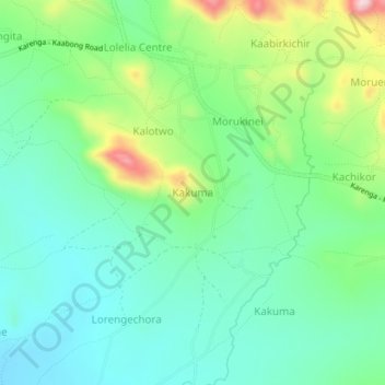
Name: Kakuma topographic map, elevation, terrain.
Location: Kakuma, Kaabong, Northern Region, Uganda (3.50100 34.02919 3.54100 34.06919)
Average elevation: 1,535 m
Minimum elevation: 1,458 m
Maximum elevation: 1,722 m
Thank you for supporting this site ❤️
Make a donation
Make a donation