
Loughgall topographic map
Interactive map
Click on the map to display elevation.
About this map
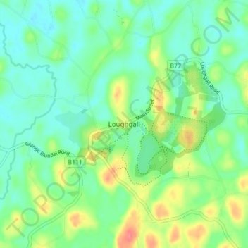
Name: Loughgall topographic map, elevation, terrain.
Average elevation: 32 m
Minimum elevation: 12 m
Maximum elevation: 74 m
Other topographic maps
Click on a map to view its topography, its elevation and its terrain.
Portadown
United Kingdom > Northern Ireland > County Armagh
Portadown, County Armagh, Ulster, Northern Ireland, BT62 1BF, United Kingdom
Average elevation: 28 m
Armagh
United Kingdom > Northern Ireland > County Armagh > Armagh
Armagh, County Armagh, Ulster, Northern Ireland, United Kingdom
Average elevation: 100 m
Lurgan
United Kingdom > Northern Ireland > County Armagh > Lurgan
Lurgan, County Armagh, Northern Ireland, United Kingdom
Average elevation: 48 m