
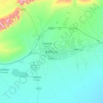
Kucha topographic map
Interactive map
Click on the map to display elevation.
About this map
Name: Kucha topographic map, elevation, terrain.
Location: Kucha, 新城街道, 库车市, Regierungsbezirk Aksu, Xinjiang, China (41.55170 82.79832 41.87170 83.11832)
Average elevation: 1,104 m
Minimum elevation: 982 m
Maximum elevation: 1,820 m