
Thank you for supporting this site ❤️
Make a donation
Make a donation
Bouillon topographic map
Click on the map to display elevation.
Thank you for supporting this site ❤️
Make a donation
Make a donation
About this map
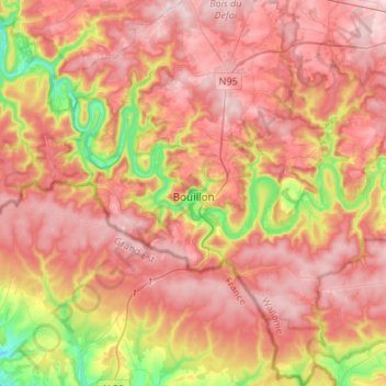
Name: Bouillon topographic map, elevation, terrain.
Location: Bouillon, Neufchâteau, Luxemburgo, Valonia, Bélgica (49.70920 4.96855 49.88368 5.18961)
Average elevation: 342 m
Minimum elevation: 168 m
Maximum elevation: 455 m
Thank you for supporting this site ❤️
Make a donation
Make a donation