
Thank you for supporting this site ❤️
Make a donation
Make a donation
Lund topographic map
Click on the map to display elevation.
Thank you for supporting this site ❤️
Make a donation
Make a donation
About this map
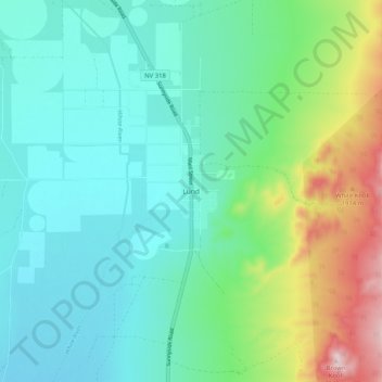
Name: Lund topographic map, elevation, terrain.
Location: Lund, White Pine County, Nevada, 89317, United States (38.81862 -115.04788 38.89862 -114.96788)
Average elevation: 1,757 m
Minimum elevation: 1,666 m
Maximum elevation: 2,039 m
Thank you for supporting this site ❤️
Make a donation
Make a donation