
Thank you for supporting this site ❤️
Make a donation
Make a donation
Torna topographic map
Click on the map to display elevation.
Thank you for supporting this site ❤️
Make a donation
Make a donation
About this map
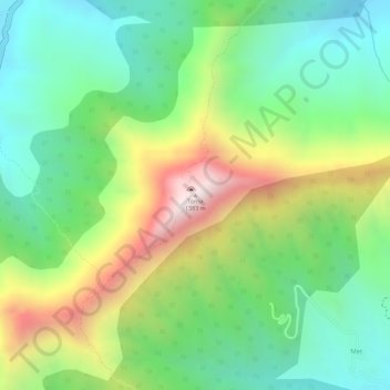
Name: Torna topographic map, elevation, terrain.
Location: Torna, Velhe, Maharashtra, 412212, India (18.27567 73.62259 18.27577 73.62269)
Average elevation: 998 m
Minimum elevation: 743 m
Maximum elevation: 1,402 m
Thank you for supporting this site ❤️
Make a donation
Make a donation
Other topographic maps
Click on a map to view its topography, its elevation and its terrain.