
Thank you for supporting this site ❤️
Make a donation
Make a donation
Howell Township topographic map
Click on the map to display elevation.
Thank you for supporting this site ❤️
Make a donation
Make a donation
About this map
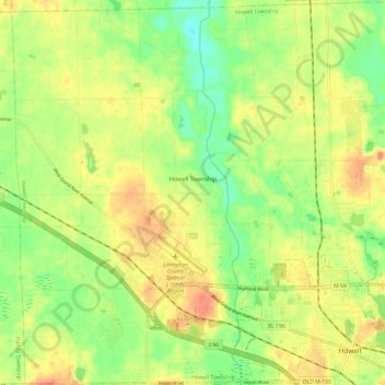
Name: Howell Township topographic map, elevation, terrain.
Average elevation: 278 m
Minimum elevation: 253 m
Maximum elevation: 301 m
Thank you for supporting this site ❤️
Make a donation
Make a donation
Other topographic maps
Click on a map to view its topography, its elevation and its terrain.
Whitmore Lake
United States > Michigan > Livingston County > Green Oak Township > Whitmore Lake
Average elevation: 276 m