
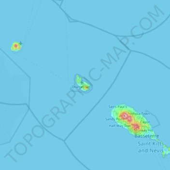
Sint Eustatius topographic map
Interactive map
Click on the map to display elevation.
About this map
Name: Sint Eustatius topographic map, elevation, terrain.
Location: Sint Eustatius, Caribisch Nederland, Nederland (17.16653 -63.28531 17.80653 -62.64531)
Average elevation: 8 m
Minimum elevation: 0 m
Maximum elevation: 1,047 m
Sint Eustatius bestaat uit een slapende vulkaan in het zuidoosten van het eiland, The Quill genaamd (verengelsing van de oorspronkelijk Nederlandse naam 'De Kuil') met een hoogte van 601 meter, en een ca. 200.000 jaar oud, uitgedoofd vulkanisch gebied in het noorden van het eiland rond de heuvel met de naam Bergje en een hoogte van 223 m. Rond Bergje liggen nog Boven, Gilboa Hill, en Signal Hill. Tussen Signal Hill en The Quill ligt een betrekkelijk vlak terrein, de Cultuurvlakte, waar ook het vliegveld en de zonnecentrale te vinden is.
Other topographic maps
Click on a map to view its topography, its elevation and its terrain.
Sint Eustatius
Nederland > Caribisch Nederland
Sint Eustatius, Caribisch Nederland, Nederland
Average elevation: 48 m
Washington-Slagbaai National Park
Nederland > Caribisch Nederland > Bonaire
Washington-Slagbaai National Park, Bonaire, Caribisch Nederland, Nederland
Average elevation: 45 m
The Quill
Nederland > Caribisch Nederland
The Quill, Sint Eustatius, Caribisch Nederland, Nederland
Average elevation: 143 m