
Gemeinde Schlitters topographic map
Interactive map
Click on the map to display elevation.
About this map
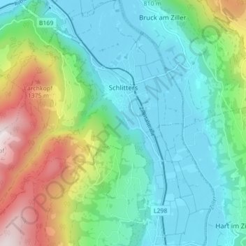
Name: Gemeinde Schlitters topographic map, elevation, terrain.
Location: Gemeinde Schlitters, Bezirk Schwaz, Tirol, 6262, Österreich (47.34703 11.78843 47.39374 11.85753)
Average elevation: 851 m
Minimum elevation: 520 m
Maximum elevation: 1,715 m
Die komplette Liste der Statistik Austria ist in: Topographische Siedlungskennzeichnung nach STAT