
Thank you for supporting this site ❤️
Make a donation
Make a donation
Mont Orohena topographic map
Click on the map to display elevation.
Thank you for supporting this site ❤️
Make a donation
Make a donation
Mont Orohena
Mont Orohena is a mountain located in the South Pacific, on the island of Tahiti. With an elevation of 2,241 metres (7,352 ft) above sea level, it is the highest point of French Polynesia. Mont Orohena is an extinct volcano and ranks 7th in the world for topographic isolation.
Thank you for supporting this site ❤️
Make a donation
Make a donation
About this map
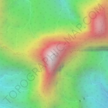
Name: Mont Orohena topographic map, elevation, terrain.
Average elevation: 1,282 m
Minimum elevation: 594 m
Maximum elevation: 2,148 m
Thank you for supporting this site ❤️
Make a donation
Make a donation