
Khabarovsk Krai topographic map
Interactive map
Click on the map to display elevation.
About this map
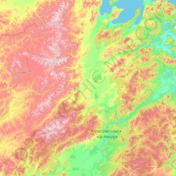
Name: Khabarovsk Krai topographic map, elevation, terrain.
Location: Khabarovsk Krai, Far Eastern Federal District, Russia (49.07127 133.56152 54.19127 138.68152)
Average elevation: 478 m
Minimum elevation: -2 m
Maximum elevation: 2,190 m