
Thank you for supporting this site ❤️
Make a donation
Make a donation
Tal-y-bont topographic map
Click on the map to display elevation.
Thank you for supporting this site ❤️
Make a donation
Make a donation
About this map
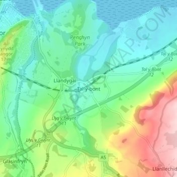
Name: Tal-y-bont topographic map, elevation, terrain.
Location: Tal-y-bont, Gwynedd, Wales, LL57 3YS, United Kingdom (53.19502 -4.11132 53.23502 -4.07132)
Average elevation: 60 m
Minimum elevation: 0 m
Maximum elevation: 203 m
Thank you for supporting this site ❤️
Make a donation
Make a donation