
Thank you for supporting this site ❤️
Make a donation
Make a donation
Clifty Falls topographic map
Click on the map to display elevation.
Thank you for supporting this site ❤️
Make a donation
Make a donation
About this map
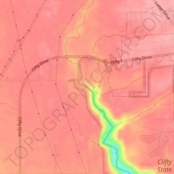
Name: Clifty Falls topographic map, elevation, terrain.
Location: Clifty Falls, Jefferson County, Indiana, United States (38.76640 -85.43629 38.76650 -85.43619)
Average elevation: 251 m
Minimum elevation: 166 m
Maximum elevation: 265 m
Thank you for supporting this site ❤️
Make a donation
Make a donation
Other topographic maps
Click on a map to view its topography, its elevation and its terrain.