
Thank you for supporting this site ❤️
Make a donation
Make a donation
Aparri topographic map
Click on the map to display elevation.
Thank you for supporting this site ❤️
Make a donation
Make a donation
About this map
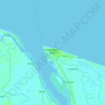
Name: Aparri topographic map, elevation, terrain.
Location: Aparri, Cagayan, Cagayan Valley, 3515, Philippines (18.31735 121.59747 18.39735 121.67747)
Average elevation: 1 m
Minimum elevation: -2 m
Maximum elevation: 9 m
Thank you for supporting this site ❤️
Make a donation
Make a donation
Other topographic maps
Click on a map to view its topography, its elevation and its terrain.