
Thank you for supporting this site ❤️
Make a donation
Make a donation
Nasisi topographic map
Click on the map to display elevation.
Thank you for supporting this site ❤️
Make a donation
Make a donation
About this map
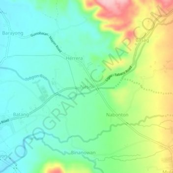
Name: Nasisi topographic map, elevation, terrain.
Location: Nasisi, Albay, Bicol Region, Philippines (13.23765 123.56462 13.27765 123.60462)
Average elevation: 114 m
Minimum elevation: 58 m
Maximum elevation: 231 m
Thank you for supporting this site ❤️
Make a donation
Make a donation
Other topographic maps
Click on a map to view its topography, its elevation and its terrain.