
Thank you for supporting this site ❤️
Make a donation
Make a donation
Manzaneruela topographic map
Click on the map to display elevation.
Thank you for supporting this site ❤️
Make a donation
Make a donation
About this map
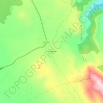
Name: Manzaneruela topographic map, elevation, terrain.
Location: Manzaneruela, Landete, Castilla-La Mancha, España (39.90625 -1.31346 39.94625 -1.27346)
Average elevation: 1,057 m
Minimum elevation: 862 m
Maximum elevation: 1,320 m
Thank you for supporting this site ❤️
Make a donation
Make a donation