
Hemmingen topographic map
Interactive map
Click on the map to display elevation.
About this map
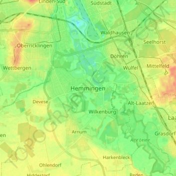
Name: Hemmingen topographic map, elevation, terrain.
Location: Hemmingen, Région de Hanovre, Basse-Saxe, 30966, Allemagne (52.28122 9.70548 52.36122 9.78548)
Average elevation: 62 m
Minimum elevation: 43 m
Maximum elevation: 85 m