
Thank you for supporting this site ❤️
Make a donation
Make a donation
Stebbing topographic map
Click on the map to display elevation.
Thank you for supporting this site ❤️
Make a donation
Make a donation
About this map
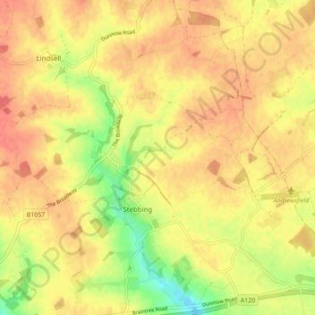
Name: Stebbing topographic map, elevation, terrain.
Location: Stebbing, Uttlesford, Essex, England, United Kingdom (51.87648 0.38486 51.92644 0.47061)
Average elevation: 85 m
Minimum elevation: 50 m
Maximum elevation: 105 m
Thank you for supporting this site ❤️
Make a donation
Make a donation
Other topographic maps
Click on a map to view its topography, its elevation and its terrain.