
Innsbruck topographic map
Interactive map
Click on the map to display elevation.
About this map
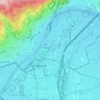
Name: Innsbruck topographic map, elevation, terrain.
Location: Innsbruck, Statutarstadt Innsbruck, Tirol, Oostenrijk (47.25837 11.38119 47.28086 11.41818)
Average elevation: 611 m
Minimum elevation: 567 m
Maximum elevation: 878 m
Other topographic maps
Click on a map to view its topography, its elevation and its terrain.
Hofwald
Oostenrijk > Tirol > Innsbruck
Hofwald, Hötting, Innsbruck, Tirol, 6020, Oostenrijk
Average elevation: 976 m