
Achterveld topographic map
Interactive map
Click on the map to display elevation.
About this map
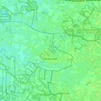
Name: Achterveld topographic map, elevation, terrain.
Location: Achterveld, Leusden, Utrecht, Niederlande (52.12481 5.43815 52.15429 5.51408)
Average elevation: 5 m
Minimum elevation: 0 m
Maximum elevation: 9 m
Other topographic maps
Click on a map to view its topography, its elevation and its terrain.